Isandula Dam Flood Forecasting System
Client
TasWater
Services
Flood forecasting for safe management of a water supply dam.
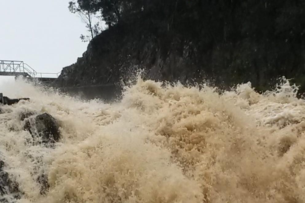
Background
TasWater operates numerous water storages throughout Tasmania. Many of these storages are decades old and require upgrading to bring them up to current standards. Prior to dam upgrades, the risks associated with these storages must be managed. Optimal operation of these storages during flood events will continue to be a requirement, even after remedial works have been completed. Floods in Northern Tasmania during winter and spring of 2016 highlighted the potential for high inflows for a number of TasWater’s storages and structures, in particular Isandula Dam. Optimising operation of the dam to minimise flood risk, whilst maintaining water supply, is a key requirement for TasWater.
Solution
The system developed for Isandula Dam is the first package of a wider system that will cover all TasWater dams and catchments. WMAwater is developing a flood forecasting and information system for TasWater, to forecast inflows, lake levels and optimal reservoir operation for Lake Isandula and, ultimately, statewide. The inception phase of the project has been completed. This involved design of a solution to meet the needs of stakeholders including Dam Safety engineers, IT, operations and SCADA engineers. The development and implementation of the system is now underway and will be operational by May 2017.
The system is being implemented using a DELFT-FEWS framework, and will integrate into TasWater’s existing IT and SCADA systems. The forecasting system takes observed rainfall and streamflows in the catchment, and forecast rainfalls from Bureau of Meteorology as inputs to a hydrological model of the catchment. This model calculates forecast inflows up to 7 days in advance. A reservoir model is used to model operating rules and storage routing, and the inflows are routed through the storage to produce forecasts of lake levels. Dashboards are provided with information on current and forecast rainfalls and lake levels, and information on alert levels. The system is fully automated and alerts are automatically sent to dam safety staff via SMS if alert trigger levels are forecast to be breached.
WMAwater is providing all services for this project including hydrographic network design, system design, hydrologic modelling, reservoir modelling and operating rule optimisation, system integration, development of dashboards and alerts, training and support.
Outcomes
The availability of richer, “live” information on observed and forecast rainfalls over the catchment, inflows, and observed and forecast reservoir levels, gives TasWater additional confidence in management of risks during a flood event, and allows for development of associated “trigger values” for dam safety emergency plan alerts.