Murrumbidgee Floodplain Risk Management Study
Client
Office of Environment and Heritage, NSW
Services
Providing an improved understanding of flood risk for the Murrumbidgee River Valley.
Background
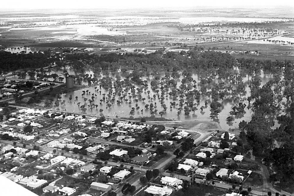
The Hay to Maude study area encompasses 80 km of the lower Murrumbidgee River with the entire study area covering some 1,800 km2. The project was undertaken in two phases, A and B. The objective of Phase A was to assess the flood risk and to identify flood and environmental “hot spots” for further assessment in Phase B. The key objective of Phase B was to develop community owned strategies for the management of the floodplain and its resources in the form of a Floodplain Risk Management Study and Plan.
Solution
Phase A of the project comprised a Flood Study and data collection, which included a desktop environmental assessment. The study area displays a complex pattern of flooding due to the expanse of floodplain, duration of flood events, existence of significant floodplain works and interaction between the river and the overbank areas and flood runners. For these reasons it was essential to select the best available technology and data to replicate the flood behaviour. A fully two-dimensional (2D) hydrodynamic model (TUFLOW) in combination with Airborne Laser Scanning (ALS) was therefore adopted to address these concerns and replicate the flood behaviour within the study area in an efficient and robust manner.
In undertaking Phase B, it was essential that the management strategies fully integrated with existing Government policy and balanced the competing demands of the floodplain ensuring flood compatible and ecologically sustainable use would be encouraged.
Floodplain development guidelines were previously developed for the study area in 1978, however were focused on the flood compatibility of floodplain management. Phase B provided an opportunity to review these guidelines against the TUFLOW hydrodynamic model and expand management strategies to incorporate environmental elements. The hydrodynamic model was also used to facilitate the evaluation of a range of other floodplain management options and strategies.
A central objective of the study was to involve the community in identification of issues and long term solutions. A Floodplain Management Committee was established with representation from DECCW, the Murrumbidgee CMA, local Council, Aboriginal groups and local landholders.
Outcomes
Community consultation, site visits and WMAwater’s knowledge of the Murrumbidgee River valley proved invaluable for successful completion of the project and a better understanding of flood risk.